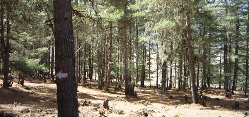
Great Himalaya Trail
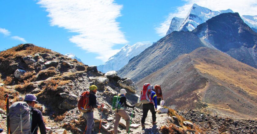
Great Himalaya Trail in Bhutan
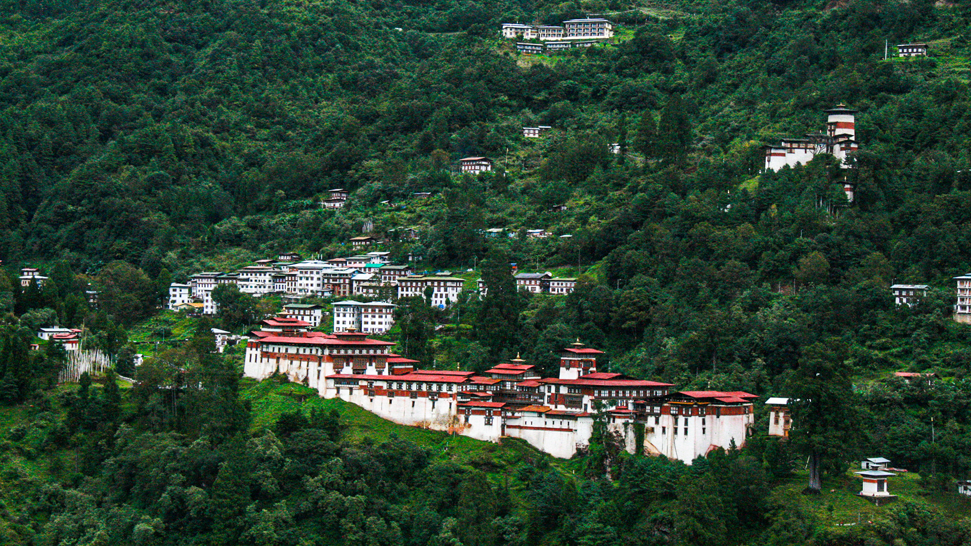 Trongsa Dzong, Trongsa
This is 40 days Bhutan tour package, one of the longest tour offered by Heavenly Bhutan and one of the world hardest treks too. Very few people have ever trekked Great Himalaya Trail in Bhutan, therefore if you are planning to attempt this, expect some surprises! Trails are rarely used, communities unused to seeing foreigners and wildlife that’s easier to spot than anywhere else. This is a land tucked away in a remote corner of the last Himalayan Kingdom, it’s a land of legends, amazing nature and embracing hospitality. The Central Himalayas of Bhutan boast some popular trekking routes, including the famous Snowman Trail, which actually isn’t as hard as some trekking companies would like you to believe! There are some amazing views, incredible hot springs, intriguing cultures and of course, nature, nature, nature everywhere!! The most popular trails in Bhutan to Laya and Chomolhari are notable for their sublime views, relatively easy trails and nature, nature, nature everywhere! The community at Laya is a real highlight and it is where the most beautiful men and women come from in the country, add some great passes and terrific trails and this is a most-do trekking area! Book the Great Himalaya Trail Bhutan with Heavenly Bhutan. 32 Days Trek in Bhutan. Great Himalaya Trail in Bhutan.
| DETAILED ITINERARY |
Day 01: Arrival in Guwahati to Samdrup Jongkhar (3.5 Hrs)
Drive from Guwahati Airport to Samdrup Jongkhar. Meet the locals: You will be able to meet many locals and you can explore the small town. Relax in the hotel: In the evening, relax in the hotel and prepare yourself for next day trek.
Day 02: Samdrup Jongkhar to Trashigang (6 Hrs)
After our breakfast we will start our drive to Trashigang. The drive is very scenic which passes through, Dewathang, Wamrong, Khaling and Kanglung before reaching our newly built hotel. We will also get opportunity to see roadside birds and animals. We will have picnic lunch. On arrival at Khaling we will spent at Khaling textile centre. This is the most famous textile centre of eastern Bhutan. Evening, check in to your hotel and relax. You can see many birds through this route. Overnight in Trashigang, altitude 1600m.
Day 03: Trashigang sightseeing
Today we will take a day excursion to Rangjung and Radhi Village. In Rangjung, we will visit the most interesting Rangjung Monastic School. The visit to Monastery will bless us for the rest of the trip and will also introduce us to the deeper practice of Buddhism in Bhutan. Today’s lunch will be with locals at local farm house. After lunch we will visit Radhi village famous for its unique weaving and red rice, where we will get opportunity to interact with the local people. Overnight in Trashigang.
Day 04: Trashigang to Tashi Yangtse (3 hrs)
After our leisurely breakfast, we will drive to Tashi Yangtse. Visit the famous Gomphu Kora. A unique festival of the east is performed in this temple annually in spring. People from as far as Arunachal Pradesh and around the country gather to witness the festival. Few kilometers away from the temple will come across a place called Dugsum where we use to see iron chain bridge built by Dupthop Thongthong Gyelpo in 15th century. It is believed that he built 108 bridges across Bhutan. He is quite famous in Paro region as well. On arrival in Tashi Yangtse, we will check in to our hotel and later we will explore the tiny town of Tashi Yangtse. Meeting with experts from eastern wooden products. Tashi Yangtse district is the only region famous with such kind of wooden products in the country. Overnight in Tashi Yangtse, altitude 1880 m
Day 05: Tashi Yangtsi to Taupang (Trek Starts)
After the breakfast, follow a rough road over a bridge across the Durgi Chu and in about 20 minutes turn right as the road switchbacks left. The trail follows a river and you cross a small tributary in 40 minutes using a log bridge before then crossing the Durgi Chu in another 10 minutes via a cantilever bridge (the most common type of bridge in Bhutan). Climb switchbacks for about 120m to three white chorten (30 minutes) where there are some fields, a couple of houses and the trails levels. Beyond the fields the trail climbs again for about 350m and another white chorten (2230m, 2 hours) and open fields used by herders. Another slight climb to the long-ago deserted village of Saksing where the trail narrows and gets muddier. Pass through bamboo forest and climb to another pasture area called Sana, which is somewhat overgrown by dwarf bamboo and where there are some deep mud bogs (1 hour and 50 minutes). From here it is another 40 minutes on a slightly improved trail to the campsite at Taupang (2569m). Time: 5.5 hours, Camp Altitude: 2,569 m
Day 06: Taupang to Pimi
Today is one of the toughest days of the whole trek and an early start is definitely a good idea. The Taupang camp overlooks the junction of two rivers, the young Durgi Chu and the Tongdala Chu, the north (right) bank of which you follow from camp. Continue through birch, oak and hemlock forest for about 1 hour before rock-hopping across the river and beginning long switchbacks up through forest. This region receives heavy rain for much of the year forming what is called cloud-forest. Spanish moss, orchids and ferns cover pine, birch and large rhododendron trees. At about 3000m come to an open area overgrown with dwarf bamboo and thistles; you may need a machete or two to get through. The trail then gets steeper and switchbacks through a broad range of rhododendron trees. Large white blooms compete with red, orange, pink and yellow varieties in what must be one of the best displays in the Himalaya. Reach the first ridge-top, the Sher Labcha (3525m, 2 hours and 45 minutes), where there is a small open grassy area with views back to Trashi Yangtsi. To your west is the upper end of a valley which you now walk around to meet the main Donga ridge which you follow for a couple of kilometers to the Dong La (3985m, 3 hours and 15 minutes). Unfortunately there are no campsites before the pass. Descend a steep rocky trail on open hillside then through forest for 2 hours to the large herding area of Pimi (3136m) where there are a couple of places to camp. The first grassy place is not the best so if you have enough energy continue for another 1 hour (100m) to some chatta (prayer flags on bamboo poles) where there is a good flat area. Time: 9 hours, Camp Altitude: 3136 m
Day 07: Pimi to Minji
This short day allows for some recovery from yesterday’s slog over the Dong La! From the end of the second grassy area, the trail enters dense forest and winds down steep muddy trails. In 2 hours and 30 minutes, arrive at a picturesque gompa (2197m) in a large grassy field, which would make an excellent campsite. Continue down through the sprawling village of Minji to another gompa, which also makes a beautiful campsite (1 hour, 1879m). There is a large festival held here on the June full moon when locals use the many masks, drums, ornate hats and three statues that are carried around for dances and purification ceremonies. One of the locals normally does an early morning puja, which you can watch. Time: 3.5 hours, Camp Altitude: 1879 m
Day 08: Minji to Thangmachu and Lhuntse
There are a few choices of what to do today, either walk down to the river and then up to Thangmachu school. Alternatively, organize a car and visit Lhuntse Dzong and then drive to the school camp. Or you could drive to the school camp and then walk the first section of tomorrows trek. A road winds slowly down from Minji to the Thangmachu bridge (1195m, 1 hour and 30 minutes) but it is much faster and easier to take the numerous shortcuts down through the village. It takes about 45 minutes to drive the 15 km to Lhuntse Dzong, which is the regional administrative centre so you cannot go inside the rooms. However, there are strong connections with the royal family that make for some interesting tales and this area is home to reputedly the finest cloth weavers in Bhutan. Ask around in the small market beneath the dzong and you’ll soon be surrounded by yards of cloth called kira, the traditional women’s dress. One kira can take a year to weave, pure silk versions can cost between Nu 40 and 80,000. The royal family have supported the weaving industry here and it has now spread all over the country. The weavers of Khoma, a nearby village, are still considered to be the best and all of the spare work (not for personal use) goes to the royal household. From the Thangmachu bridge, it’s a 40 minute drive or an uphill walk for 3 hours and 30 minutes using both the rod and shortcuts on corners to the school at the top of the hill. You will have to request permission to camp from the headmaster. Time: 1.5 hours, Camp Altitude: 1195 m
Day 09: Tangmachu to Ungar
Just on the western side of the school is an old kani (gateway), mani wall and two derelict prayer wheel chorten. Follow the trail here as it gradually descends to a stream which you cross in 35 minutes (roughly 200m down) and then begin a gradual ascent past a small village and on to a functioning water-driven prayer wheel in 55 minutes. The trail then dips through a small watercourse before climbing to a white stupa on the Youmin La (2038m, 1 hour and 30 minutes). Do not continue straight around the hillside, instead ascend the trail immediately behind the stupa and in 10 minutes pass a small herder’s shelter or bamboo. Just beyond is a potential campsite. The trail then undulates slightly as it traverses steep hillside above Youmin village to another white stupa (2036m, 50 minutes), and shortly after you climb about 200m to a third white stupa (2282m, 45 minutes), which is also referred to as the Youmin La. The trail is now wonderfully flat to Shukang (2 hours and 30 minutes) where locals say the gompa was built by Tsong Karpa in the 8th century. It’s then a long descent on a trail that links small villages all the way to a bridge over the Ungar Chu and a campsite beneath the village (1750m, 1 hour and 15 minutes). Time: 8.5 hours, Camp Altitude: 1750 m
Day 10: Ungar to Pemi
Wind around the base of Ungar village across terraced fields to small river that flows down from the southwest. Cross via a log bridge and immediately begin climbing switchbacks through dense forest. There are many animal trails so it is wise to continue following the largest route, which is sometimes steep and muddy. After roughly 2 hours and 30 minutes you come to an open grassy area (roughly 2400m) on the ridge used as a grazing place by the people of Ungar. The gradient begins to ease from here as you now follow the ridgeline. Occasional flat sections through cloud forest make for an enjoyable climb. Another larger flat section in forest (2680m, 1 hour and 30 minutes) makes a good lunch spot. Continue climbing and traversing the odd flat section along a narrow ridgeline until you reach the beginning of a large open area of dwarf bamboo and grass. The whole hilltop area is called Pemi (3032m, 1 hour and 30 minutes) and a ruined building, said to be used by previous Kings as they toured the region, sits near the only water source. Before reaching the ruins there is a flat-ish area with bamboo herder shelters, this is the only potential campsite on this side of the Rhodang La. Water can be found in forest on the northern side of the ridge. Time: 5.5 hours, Camp Altitude: 3032 m
Day 11: Pemi to Ugyen Choling Palace
The first 1 hour of trail is along the ridgetop and only climbs a little. There are excellent views back to the Don La and to distant mountains northwards. The climb to the Rhodang La (3860m, 2 hours and 45 minutes) is steep and winds around craggy outcrops of rocks that were a challenge to the trail builders. Most of the steps and stonework are about 100 years old and most are still in excellent condition. The ridge is barely 3m wide when you reach a few prayer flags but soon widens as you continue heading west and climbing a gentle gradient to the Phul La (4135m, 1 hour and 15 minutes) passing a couple of derelict stone huts en-route. It’s a broad and easy descent from the pass, a distinct contrast to the climb up! After roughly 45 minutes the descent becomes a long gentle downward traverse through pine and rhododendron forest to Phokpey camp (3790m, 1 hour and 30 minutes), so named after the village in the valley below. If you are tired camp here, otherwise continue across the grassy area and follow a trail down through bamboo forest. Over the next 1 hour and 30 minutes you pass through all four types of bamboo used in Bhutan – the dwarf variety (up to 1 metre) is used to make arrows, a slightly larger variety (upto 2m) is used for weaving mats and bowls, a variety that grows up to 4m or so is used for strong baskets and heavy duty household items, and the largest variety (up to 6m) is used as a building material. Once in the main valley there are many trails through the bamboo and then mixed broad leaf forest and local knowledge is helpful. The surrounding valleys are called Bumthang, which is also the district name that covers much of central Bhutan. Ugyen Choling Palace (2915m, 2 hour and 30 minutes from Phokpey Camp) is the home of the first King of Bhutan’s uncle and is a really interesting museum where you can stay. There is a campsite beneath the Palace (15 minutes) beside the main river below but I’d recommend staying in the Palace. Time: 9 hours, Camp Altitude: 2,915 m
Day 12: Ugyen Choling Palace to Tangbe
From the chorten in front of the Palace descend for 15 minutes to a small village where there are a number of camping spots. Do not enter the village, instead turn right at a chorten, cross a new wooden bridge and then walk down an avenue of willow trees to bridge over the Tang Chu (2744m, 10 minutes). Warning! If you are allergic to bee stings DO NOT cross this bridge – there are many hives on the far side and bee attacks are reported. There is another bridge about 15 minutes further upstream. Both trails lead to the same dirt road being built to a nearby village. Follow the road for about 30 minutes and where it begins to climb a little there is a trail heading left down to a small river. From here you can choose which route is better for you: Option 1. River trail – this a more direct and considerably faster route up the valley but after rain the bamboo forest section is very muddy. Option 2. Village trail – continue on the road and then pass through a village on your left. On the far side of the community, wind around fields and across some pastures to rejoin the river trail. Once on the main trail in the river valley continue to climb easy gradients to a large white kani (gateway) and some small chorten (3283m, 1 hour and 30 minutes via river trail or 2 hours and 15 minutes via village trail). From here it is an easy 45 minute climb to the Phe Phe La (3545m) through rhododendron, pine, spruce, hemlock and magnolia forest. It’s an easy descent on a trail that is washed out in many places to a large meadow at Trashiling (aka Nalakhang, 2860m, 2 hours and 30 minutes), which is a popular campsite. The next section of trail isn’t particularly interesting so if you have the energy continue to the next camp. Head down-valley from the campsite through alternating grassy pastures and pine forest. The trail is often muddy so you’ll become expert at balancing on slippery bowling-ball shaped rocks almost completely submerged in mud. Come to a bridge in 1 hour 15 minutes which you cross and then continue heading downstream on a dirt road passing villages to Koling (2692m, 30 minutes) where there is a grassy area or 10 minutes further to Tangbe where there is another grassy area and shop. Most horse-drivers stop here and your next connection is 7 km (by road) away, so most crew will organize a 4WD car to transport all the gear. You can walk along the road, or get a lift in the car, neither option is particularly thrilling! Time: 8-8.5 hours, Camp Altitude: 2692 m
Day 13: Tangbe to Chochomey
The roadhead for the next section of trail (Snowman Trek) is Menchugaon, a scruffy place where road-workers live. If you walk from Tangbe it will take 2.5hrs, or it’s a 30 minute drive. Cross the bridge beyond the roadhead and follow riverside trails on the west (left) bank. Do not follow the new road to Dur village. The trail passes through some pleasant grassy areas, which used to be used as campsites before the road was extended to Menchugaon. If you walk from Tangbe, this could be a good place to stop if you require time for resupplies to arrive. After walking for 1 hour and 30 minutes (roughly 2800m) the trail begins a switchback climb to Ghoresum (3100m, 1 hour), which is another campsite. The gradient eases but the trail becomes muddier and muddier from here as you climb through bamboo forest to Chochomey (3245m, 1 hour and 45 minutes) where there is a simple herder’s shelter. Time: 4-4.5 hours, Camp Altitude: 3245 m
Day 14: Chochomey to Kurpang, 6hrs, 700m
Yesterday’s trail will give you a good idea of how much mud there might be today, and certainly expect conditions to be much worse. If locals have been taking their animals up to the high pastures then this will make things even muddier. If the trail is in good condition then you will be able to continue through to Tshochenchen and extend the amount of time you can spend at the hot springs! From Chochomey the trail heads into dense forest as it gradually descends to a bridge over the Dur Chu (3080m, 1 to 3hrs depending on trail condition) where you then climb the east (right) side of the valley to a large grassy area (3245m, 1 hour) before passing through a short forest section and coming to an even larger grassy area in 15 minutes. A brief pretty forested section gives way to a very muddy trail as you climb steep hillside, which also has some loose landslides. In 2 hours and 30 minutes you come to Kurpang (3568m), a grassy riverside campsite that’s popular with herders. If the trail has been tough going you may want to rest here. Time: 6 hours, Camp Altitude: 3568 m
Day 15: Kurpang to Djule Tsho
The trail heads through some fine rhododendron and pine forest which although has some muddy sections is generally a joy to walk on. In 1 hour and 40 minutes reach a bridge (3916m) over a tributary of the Dur Chu. After crossing the bridge there is a short section of switchbacks before the gradient eases in dense rhododendron forest and you enter a pretty alpine valley. A few herder’s huts in the far side of the valley and a trail-side campsite are called Tshochenchen (3954m, 30 minutes from bridge) and is a popular campsite for those lucky enough to have had no mud!! Continue up the valley on the east (right) bank of the now infant Dur Chu. In 30 minutes the valley turns west (left) at about 4080m and the trail starts to climb the north (right) hillside to a small tributary valley. It takes about 1 hour and 30 minutes to complete the climb to a herder’s hut, which has some large stone slabs as a windbreak (4373m). Ahead there are two waterfalls. The left hand waterfall cascades over dark rocks and it is these that you now climb to first pass Animo Tsho (4540m) and then on to the Djule La (4685m, 1 hour and 20 minutes from hut). The trail is a little steep and rocky towards the pass, which is marked by cairns, chorten and prayer flags. From the top of the pass you can see the large Djule Tsho below, to get there descend northwesterly to a small flat area (30 minutes) where a melt-water streambed forms the trail down to the main valley. There is a herder’s hut and campsite (20 minutes) on the eastern side of the lake but if you have time continue around the northern bank of the lake to a herder’s hut at the very western end of the lake (4339m, 30 minutes) where there are views of the Mangdu Chu valley and reflections of craggy peaks in the lake. Time: 6.5-7 hours, Camp Altitude: 4685 m
Day 16: Djule Tsho to Dhur Tshachu
A trail climbs north-northwest from the herder’s hut around a couple of spurs and then to the Kutong La (aka Gongto La, 4391m, 30 minutes). A steep switchback descent across open hillside brings you to another herder’s hut in a small valley (4177m, 30 minutes) and back to the treeline. Some sections of trail now traverse through pine, birch and rhododendron forest but it is pretty well all down to the hot springs at Dur Tsachu (3393m, 2 hours). All of the spring waters are collected in wood-lined ‘tubs’, the hottest ones becoming heavily calcified. The highest springs are the hottest at 52.3C, the middle section of tubs are around 42-43C (some have a green algae that needs to be cleaned out) and those beside the Mangdu Chu are around 38-40C. A long soak while watching clouds in an azure sky float by overhead, the swaying pine trees and numerous birds flitting back and forth is just about the best possible reward for making the effort to get here. Each pool has specific therapeutic properties, except for the hottest pools, which are said to be good for all round health. Lie back and enjoy a sense of tranquility that only Bhutan can offer! Time: 3 hours, Camp Altitude: 3393 m
Day 17: Dhur Tsachu to Warthang
The trail heads upstream on the east (right) bank of the Mangdu Chu for 30 minutes to a bridge, which if it hasn’t been recently repaired (post-monsoon 2010) then your horse driver may refuse to take his animals across. We unpacked the horses and took them across one by one. The bridge is not very stable and when it swings or bounces the horses get spooked, some of the wooden planks are rotten as well. Once on the west (left) bank the trail climbs a little through forest before coming to what looks like a landslide or small GLOF (Glacial Lake Outburst Flow). Beyond is a herder’s hut and potential campsite (3475m, 45 minutes) but this is not the trekking route. The trail has been damaged by whatever has caused the damage to the stream before the camp. Climb the rocky debris for about 100m and you’ll find the trail to the north (right) side of the stream. It’s now a long switchback climb to clear the treeline and then across some shallow alpine valleys to the Nephu La (aka Napthang La, 4603m, 4 hours). A large alpine valley is on the far side of the pass where there are a few herder’s huts. Camp beside one which is unused (there are frequently locals here) and you’ll probably find that this is where you change your horses for yaks. The entire valley is called Warthang (aka Uruthang, 4534m, 30 minutes from pass). Time: 5.5-6 hours, Camp Altitude: 4534 m
Day 18: Warthang to Minchugang
Passing a large rocky mound in the centre of the Warthang valley head north following a watercourse to what looks like a dead-end (30 minutes). A stream cascades down rocks to your north-northwest and the trail climbs to the right of it, steeply at first, but once on top of the rock section the gradient eases to the Warthang La (4779m, 1 hour). Traverse above a small lake before descending to another slightly larger lake (4728m, 15 minutes) – do not descend any further! Instead, head northwest over grassy mounds passing a herder’s hut before beginning to climb again. The gradient quickly becomes steep as you climb grassy slopes, which become muddy switchbacks and then a rocky trail as you reach the Sake La (aka Saga La, 4982m, 1 hour and 15 minutes). Care should be taken on the steep descent as ice often underlies loose earth making for some skiddy sections. In 30 minutes reach the side of a pretty turquoise lake where the trail becomes sandy on a gradual descent to herder’s huts at roughly 4700m in another 20 minutes. Then climb to a ridge with chorten and some prayer flags called the Bragdi La (4751m, 30 minutes from lake) where you look down into the large Gangkar Pheunsum Chu (aka Sasha Chu) valley. A large, steep grassy hillside lies beneath your feet and there are a number of routes to choose from. Probably the easiest is to traverse right above the grassy slope towards a craggy ridge before which you descend steeply. Alternatively, cut diagonally across the hillside heading down to the bottom of the craggy ridge, but this route involves following animal trails and threading through dwarf rhododendron at times. Do not descend to the river! On either route you will come across a trail that heads across the bottom of the slope about 100m above the valley bottom. Follow this trail up valley heading northwest (right) and in 1 hour and 20 minutes descend slightly to a grassy area next to the river called Minchugang (4294m). From mid-May you might be lucky and find blue, pink and yellow poppies near the camp. Time: 5.5 hours, Camp Altitude: 4294 m
Day 19: Minchugang to Zanum
Today offers some wonderful trekking as you gradually climb towards Bhutan’s highest peak at the end of a spectacular alpine valley. If you are here in late spring or the summer months the valley is a carpet of flowers, including the rare blue, pink and yellow poppy. The trail remains on the east (right) bank of the river as you ascend what feel like giant terraces from one section of alpine U-shaped valley to another. The lower broad valley areas both are called Gechey, the first is Gechey Woma (4477m, 1 hour and 30 minutes), which continues for another 50 minutes to some more herders huts (4613m) before the trail climbs again. The second, in another 1 hour, is Gechey Koma (roughly 4740m) where the herder’s build temporary shelters when moving yaks up and down the valleys. From here large hills of ancient moraine narrow the valley before the last broad valley section, Zanum (5046m, 2 hours) where you can camp at the base of the branch valley that leads to tomorrows pass. This section of valley is worth exploring a little as there are plenty of mountain views to enjoy. At the head of the valley is the Gangkar Pheunsum massif (7541m). The Bhutanese don’t have a strong tradition of naming peaks so one name often refers to a number of mountains within a range. Certainly the spire-like peaks that form the north end of the Gangkar Pheunsum range are stunning in the afternoon light. Time: 5.5 hours, Camp Altitude: 5046 m
Day 20: Zanum to Tshorim
From the main Zanum valley walk into a smaller side valley surrounded by moraine, which heads west. There are a number of routes into the valley, but there is a ‘main trail’ that stays on the southern (left) moraine hillside. Gradually climb to the top of the moraine to your south (left) where you can see a chain of craggy peaks to the south and between them and you is a glacial lake (roughly 45 minutes from camp). At first it seems like you are heading for a long flat ridge to your northwest (right) but this is not the case. Behind you are some great views of Gangkar Pheunsum. Continue climbing up and down a long moraine ridge heading west while keeping well above the glacial lakes (a second soon comes into view) to your south. After 1 hour and 20 minutes the trail enters a narrow ablation valley, which you climb to the end and then you get the first view of the cairns and chorten on the pass ahead. However, to get there you have to cross a shallow valley with another two glacial lakes. A scrambly trail heads around the northern (right) bank of the larger lake, the animal route crosses a narrow piece of moraine that separates the two lakes before a slight climb to the Gohpu La (5466m, 45 minutes). The pass is broad with numerous cairns, chorten, prayer flags and some walls that act as windbreaks that are welcome as you relax and enjoy some great views! The pass is highly decorated as it marks the Bumthang-Lunana district boundary. The descent from the pass is on an easy trail that passes a couple of small lakes, you should stay on the north (right) side of the valley. In 1 hour you come to Tshorim (5344m), which means ‘long water’ where there is a campsite. If you continue to the end of the lake and second a little more there is a much more sheltered spot to camp, also referred to as Tshorim (5315m, 50 minutes). Time: 4.5 hours, Camp Altitude: 5315 m
Day 21: Tshorim to Thanza
The mountain views around you and along the trail are great today! Stay on the northern (right) side of the Tshorim lake outflow as you descend an easy trail over rolling moraine to a broad valley called Sumji (4853m, 2 hours and 15 minutes). From here you ‘step’ down to different campsite options the most popular of which is Dangey (4674m, 40 minutes). Near Dangey is a log bridge, which leads to the Nicochu La, Tsho Chena and the route of the ‘Half-Snowman Trek’. The trail quickly descends to the river, which it follows for roughly 45 minutes (4477m) to a point that you start to climb hillside. It’s not much of a climb before you start traversing but the river falls away rapidly in a series of waterfalls so it at first looks higher. In roughly 40 minutes come to a ridge that sticks out a bit further than the others and offers good views up and down the valley, especially of Thanza and Table Mountain, now renamed after the 4th King Gangkar Sinjey. The extensive damage caused by the 1994 GLOF are also evident. There are a number of places to camp in the valley bottom; the first and most popular is near the Flood Warning Centre in the new village of Thanchor (aka Thenchey, 4147m, 30 minutes). Or you can head 20 minutes up-valley to Thanza, which could possibly be the highest permanent settlement on earth (4165m). Time: 5 hours, Camp Altitude: 4165 m
Day 22: Thanza to Lhedi
You have another trail choice today, either via the village of Cheoza or a direct trail. Take the old trail on the west (right) side of the Phu Chu valley to reach the village of Cheoza (2 hours and 30 minutes from Thanza), which has an old fortified gompa that the locals call a dzong in the centre of the village. I walked this route in a fierce snowstorm so I didn’t explore. Instead I took the direct route down the east (left) side of the flat valley below Thanchor to a bridge (4000m, 1 hour and 30 minutes) that crosses to the main trail beneath Cheoza. You then stay in the rough valley carved by the river – beware of rockfall! In 30 minutes you emerge into another broad valley that has also been scoured both by the 1994 GLOF and the monsoon floods of 2009. The devastation to what once a beautiful forested valley shows the merciless power of nature and climate change. Reach Lhedi (3728m, 2 hours and 15 minutes) where you can camp in the school grounds. Massive boulders seem to hang precipitously on the steep hillside above the village while the Phu Chu is constantly trying to wear away the remaining grazing and farming land; a more precarious existence is hard to imagine. Time: 4-5 hours, Camp Altitude: 3728 m
Day 23: Lhedi to Wochey
From the end of Lhedi descend to the broad sandy and rocky riverbed, which you walk along for 50 minutes to a where a river cascades down into the valley. Some grinding mills make use of the torrent that you cross via a small cantilever bridge (3661m). Continue passing through a hamlet along a trail that gradually climbs for about 30 minutes and then the gradient increases to Dengar (aka Tega, 3945m, 1 hour and 45 minutes from cascade). From above the 8 or 9 homes in Dengar there is a viewpoint of the Thanza valley and Table Mountain, which provides a chance to rest and figure out which of the three trails ahead you should take. The trail that heads southwest goes to Punakha, to the west is a large track that leads to village grazing areas, so the one you want heads northwest towards a craggy hill. Climb easy switchbacks through rhododendron forest to a small alpine valley where a hermit from Dangey has taken up residence and may be chanting by the trail. The trail gets steep as you now climb to the Kechey La (4661m, 2 hours from village) and then descend past two lakes into the Wochey valley. As you pass the second lake you can see the village at the valley mouth, which gives the valley its name. There are campsites on either side of the river in the valley bottom (4156m, 1 hour and 15 minutes). Time: 5.5-6 hours, Camp Altitude: 4165 m
Day 24: Wochey to Tarina
Begin by crossing to the north (right) bank of the Wochey Chu and heading downstream on a good trail through some lovely pine and rhododendron forest draped in Spanish Moss. In 1 hour reach Wochey village (3911m), a collection of maybe a dozen homes. Just beyond the village is a trail junction where you must turn north (right) – do not descend on the left folks. The trail then climbs very briefly as it rounds the final spur out of the valley and then you have a long steep and muddy descent to the Tarina Chu (3642m, 45 minutes). Follow an easy trail on the east (right) bank through forest, across landslide debris and the occasional grassy area, the largest of which has lots of rubbish left by locals (3883m, 1 hour and 40 minutes). Just beyond is a bridge over the Tarina Chu and for the remainder of the day you follow the west (left) bank of the river. In about 1 hour come to another smaller grassy area before heading across alluvial or landslide debris spread across the bottom of the valley. In another 1 hour and 15 minutes the trail comes to dwarf and scrub rhododendron with some grassy areas, which is called Tarina camp (4099m). Time: 5.5-6 hours, Camp Altitude: 4099 m
Day 25: Tarina to Narithang
Climb through rhododendron forest on a sometimes rocky trail. The gradient increases as you ascend switchbacks and a good rest stop is a large rock after 1 hour, which offers views of surrounding peaks and the valley below (roughly 230m of ascent). The trail then begins traversing southwest into a high tributary valley that is far too steep to access directly from the campsite. Climb up through this valley and then more switchbacks to the high moraine-covered plateau (4968m, 2 hours and 30 minutes from camp) that eventually leads to the pass. Trek past a small lake to your south (left) as you ascend moraine and shallow ablation valleys to a bowl-shaped valley beneath the Karakachu La (5215m, 1 hour and 45 minutes), which is a narrow ridge covered in prayer flags and cairns. The western side of the pass is broadly called Narithang and is a series of shallow grass-covered valleys surrounded by moraine. Long ago this must have been a heavily glaciated region but now there is only one small glacier flowing down from some craggy mountains to your south. There are plenty of campsites to choose from it just depends on how long you want to walk. There is a nice sheltered spot after 1 hour (4911m) that I’m told is popular with groups but not herders, which is why there isn’t much animal dung. Time: 6-6.5 hours, Camp Altitude: 4911 m
Day 26: Narithang to Rodophu
The trail heads west across shallow valleys and rolling moraine. About 1 hour from camp you cross a saddle on a moraine ridge marked with a cairn (4907m) before descending into a large shallow valley. Keep heading west to another moraine ridge with chorten and cairns called the Ladam La (4906m, 1 hour). There is a descent of roughly 50m from this pass into a slightly deeper valley which you cross to a ridge and the Tshumo La (4878m, 30 minutes), which has two large decorated cairns that mark the Laya-Lunana boundary. Around the base of the cairns were fresh snow leopard tracks only a couple of hours old! A short descent leads to a shallow basin from where the trail continues down a rough and loose steep trail for roughly 100m to a large valley. Walk to the rim of the valley and follow the route of a stream that cascades about 400m to a flat-bottomed alpine valley and your camp, Rodophu (4270m, 1 hour and 20 minutes), where there is a tourist hut being built. At the head of the valley is the impressive Tsheda Kang peak. Time: 5 hours, Camp Altitude: 4270 m
Day 27: Rodophu to Laya
Walk down the flat valley to a bridge that leads to some herder’s shelters. From here the gradient begins to increase as you descend through rhododendron, pine and birch forest. I had a great time bird spotting on this trail as fire-tailed sunbirds caught insects in mid-flight and blood pheasants danced for their mates. There are Himalayan Black Bears in the forest so take care on tight corners as any chance encounters would not be a good idea. As you descend the valley narrows considerably and at roughly 3600m you climb about 150m to avoid a landslide before traversing steep hillside to a spur that marks the mouth of the valley. Descend to a ruined herder’s hut and grazing area (3655m, 3 hours from camp). The trail now turns northwest (right) into the Laya Chu valley and descends switchbacks down to the main Laya-Gasa trail (3381m, 30 minutes). This main trail feels like a highway compared to the morning’s route and you’ll likely meet locals, traders and army heading up and down. There is an army checkpost (3431m, 35 minutes) where you have to register before crossing the Thakimarka Chu (aka Togtsherkhagi Chu) that flows down from Masang Kang (note the trail to Masang Kang Base Camp on the far side of the river). A helipad is on the far side of the river and from here continue following the Laya Chu upstream on the east (right) bank. In 20 minutes you pass the confluence of the Laya and Lungo Chu (Laya Chu heads west, Lungo Chu comes from the east) and then very shortly come to a bridge over the Lungo Chu. Cross the bridge (3435m) so that you can continue following the Laya Chu. Now the trail begins to climb, gradually at first, past some farm buildings and a square chorten. The gradient increases a little but is never very steep. Continue past some more chorten before coming to a flat area shaded by large pine trees, which mark the boundary of Laya village in 1 hour. A short section of switchbacks brings you to the first houses in 10 minutes. There are a few potential campsites in or around the sprawling community so it may be another 10 or even 20 minutes before you reach camp. I stayed above the village (3922m) to avoid the village dogs as much as possible. Special Information: Tashi Lakhang In the centre of the village is a large two stories building that is used to be the community ‘safe-house’ where collected taxes were stored and locals kept valuables. Arrow slits on the ground floor are testimony to the buildings fortress-like history. In the time of the third King of Bhutan the building was converted into the village Lhakang (monastery), the site of the smaller original building is marked by a juniper tree and chorten near the gompa. Inside is a fine statue of Avolokishwara (Buddha to Remove Obstacles), the protector of Laya, Mayum seated on a horse (a recent donation from the current King) and many thanka, frescos, smaller statues and objects used in the annual festival that celebrates the Zhabdrung coming to Bhutan (held on the 3rd and 4th of April). The Zhabdrung created Bhutan in the 17th century after fleeing Tibet to take the protection of his friend and confidant, the King of Gasa. Every third year (the next time is 2011) the festival has dancing as well as a large puja. Time: 6 hours, Camp Altitude: 3,800 m
Day 28: Laya to Limithang
Head to a group of about six houses at the far western end of the village to find the trail to Limithang. As you pass through the village you might notice that a couple of houses have a decorated white box on the rear wall. This shows that someone within the house has been suffering from an ongoing illness. Every home has a spirit house, normally on a rear or side wall, but locals believe that sometimes a spirit can become unhappy with this ‘home’ and causes disturbances that result in illness. To placate the spirit another spirit house is built, decorated with Buddhist motifs and placed beneath the eves above the original spirit house. From the houses descend past a thin white chorten and then a gradual down for roughly 20 minutes to the Laya Chu. The trail then climbs a little for the next 50 minutes before descending once again to the river, which you reach in another 30 minutes. Pass through a grassy glade of pine tees for 10 minutes to a bridge over the Laya Chu (3832m) which you cross to the south (left) bank. The trail now leaves the main valley to head west up a tributary valley. Just as you start climbing there is a tree beside the trail covered in offerings. High on the far side of the valley is a gompa that Laya locals believe protects their village and to which each house has to make an offering. However, the gompa is very far and the trail dangerous, so rather than going to the gompa they visit this spot from which they can see the gompa and place the offering on a small wooden alter at the base of the tree or they tie it in the branches. The trail first climbs across a landslide before heading up through forest for about 250m. Reach some herder’s huts (4082m, 50 minutes) where the gradient eases and you pass another herder’s hut. Pine, juniper and rhododendron forest fill the valley as you continue to gradually climb the north (right) bank of a small river. A couple of craggy rock towers dominate the valley to the north and are a stark contrast to the grassy slopes to the south. Great Tiger Mountain appears at the end of the valley, a grey moraine wall at it’s base. As you approach the moraine wall you can see a large grassy meadow, called Limithang (4163m, 1 hour), which is spread across much of the valley floor. Also note a couple of herder’s huts built against large boulders to your right. Camp as close to an old forested section of moraine wall as you can. Time: 4 hours, Camp Altitude: 4163 m
Day 29: Limithang to Thankhasam
Head up the grassy meadow to find a large trail that passes through rhododendron forest where you might spot some blue poppy among many primulas. There’s many mountain views to enjoy as you reach a herder’s hut in 50 minutes where there are more blue poppy. A short rise leads to a broad flat-bottomed valley with a couple of large boulders standing in a grassy area that would make a good camp (4442m, 30 minutes). There are a number of trails ascending steep rocky slopes from here, the one you need the switchbacking trail to the southwest, which leads to a series of shallow valleys and moraine hills. Climb the main moraine ridge keeping the largest shallow valley to your left all the way to the Sinchey La (5015m, 2 hours). During the climb remember to stop and turn around to enjoy views of snowy mountains all the way to Table Mountain above Thanza! On the far side of the pass the landscape changes to brown and ochre hues and rolling slopes reminiscent of the Tibetan Plateau. In 40 minutes reach a potential campsite in a broad valley, Chuthana (4675m). Stay on the south (left) side of the valley as you continue to descend gradually before swinging sharply south (left) to a herder’s hut (4577m, 40 minutes) used by Forest Department staff who live here from mid-March to the end of September to protect the resident Takin population. Consult with them regarding routes around or through the ‘Takin Zone’. We were sent on a circuitous route around the head of the valley on some very rough trails that descended to the river (4028m, 1 hour and 20 minutes), passed a ruined dzong before heading up a tributary valley and a small campsite called Thankhasam (4054m, 50 minutes). The main valley once had dozens of hot springs and a large resident population (thus the dzong) but that was long ago and the springs have disappeared. It is thought the Takins like this valley because of the residual salts in the earth and vegetation. Note that the main post-monsoon campsite of Tsherango is closed in the pre-monsoon months. If you cross the ‘Takin Zone’ your crew and horsemen will likely have to pay a fine. Time: 7 hours, Camp Altitude: 4054 m
Day 30: Thankhasam to Shakyapassa,
Cross a small log bridge next to the camp and climb switchbacks through rhododendron, spruce and birch forest. The gradient eases a little as you emerge from forest but resumes again as you approach the Jari La (4747m, 2 hours and 20 minutes) marked by chorten and prayer flags that mark the border of Laya and Lingshi districts. The first 200m or so down is steep to a small stream where the gradient then eases. Follow the stream on the north (right) bank to a grazing area and herder’s shelter (4399m, 45 minutes) where you cross the stream to the south bank before crossing back again after 10 minutes. The trail then traverses hillside as the stream falls away below. Do not descend to the stream or to the herder’s huts you pass in about 20 minutes. Instead, stay high and head for some herder’s shelters you can see on a ridge at the end of the valley. Note there is a sky-burial place on top of the rocky crags above which you should avoid, but explains why Himalayan Griffin are so common in this valley. From the herder’s shelters begin a long traverse around steep grassy hillside to your northwest (right). The trail descends slightly but then steeply as you enter a pretty alpine valley with a meandering river. The whole valley is called Shakyapassa (4000m, 1 hour and 15 minutes) and there is an excellent campsite next to the river. Time: 5 hours, Camp Altitude: 4000 m
Day 31: Shakyapassa to Tekethang
Walk down stream to a bridge that leads to a lone herder’s hut and where the trail heads into forest. Climb a sometimes steep trail for 50 minutes to a grazing area where water is scarce as its name implies, Chumigey (water-no-place, 4188m). A short climb around a ridge at the far side of the pasture is followed by a gradual descent past a salt-lick popular with blue sheep judging by the tracks. Continue down to another small grazing area next to a stream that could be used as a campsite (4156m, 40 minutes) before beginning the long traversing climb to the Goku La (4445m, 1 hour). From the pass traverse steep hillside until you are overlooking the Chebisa valley into which you descend and walk through the village. It is possible to camp here (3880m, 1 hour) but it makes for two short days so we pushed on. Wind around a large ancient moraine wall to Gangyul village (3810m, 1 hour) which sits beneath a massive overhanging rockface and at the head of the valley the impressive bulk of Tserim Kang. An easy traversing climb ascends another moraine wall to a cairn before climbing a short section to a slightly higher section of moraine marked with cairn and prayer flags (4133m, 50 minutes). The trail can be seen winding around hillside as it heads up the north (right) side of the Linghsi valley, which was once a penal colony. Lingshi village (4070m, 1 hour) is dominated by Yugyel (aka Ugyel) Dzong, which was built by the Zhabdrung in the 1600s and is undergoing partial restoration. Tourists are not permitted to camp in the village, instead continue around hillside on the far side of the village, pass a large chorten and descend to a broad valley called Tekethang (4025m, 30 minutes). If you have a rest day at Lingshi then it’s a good idea to visit the dzong, the school with some very friendly children and the post office, which is popular with stamp collectors. Time: 6 hours, Camp Altitude: 4025 m
Day 32: Tekethang to Jangothang
Climb the ridge to the west through dwarf rhododendron to a cairn (4375m, 1 hour and 15 minutes) and views of the valley below and dzong. The trail now gently climbs a valley heading west. After 1 hour (4445m) cross a stream and begin climbing across loose schist towards the Nyele La (4880m, 1 hour and 15 minutes). A short steep descent on schist brings you to a small bowl-like valley and then to a much larger U-shaped valley. Walk to end of the valley staying on the north (right) side of the small river before a steep descent to the Jichu Drakey Chu (4220m, 1 hour and 40 minutes) dominated by a large moraine wall at the end of the valley. Turn left once crossing a bridge and pass three traditional Bhutanese homes before reaching the tourist hut at Jangothang (aka Jongothang, 4106m, 25 minutes) at the base of Jomolhari (aka Jhomolhari), one of Bhutan’s most sacred mountains. Time: 5.5 hours, Camp Altitude: 4106 m
Day 33: Jangothang to Takengthanka
We linger in camp hoping for mountain views but like most days we’re out of luck. It’s a gentle 30 minutes down to the forest office and health post, after which there is a village or hamlet every 20 to 30 minutes. At Takethang (3910m, 1 hour) the valley walls close in to become a steep-sided river valley and enter pine and birch forest. The trail now has some muddy sections but nothing too bad. In another 1 hour reach the white chorten in a grazing area at Rajitoyah (3795m) and in another 15 minutes you’ll need to register at the army post (3775m). The trail is rocky and muddy from here down to the tourist hut at Takengthang (3618m, 40 minutes) were there are views of Jomolhari if you’re lucky! Time: 3.5 hours, Camp Altitude: 3618 m
Day 34: Takengthang to Shana
The bridge (3541m) to Yaksa is 15 minutes downstream – do not cross it! Instead continue for another 5 minutes to a second bridge, which you cross to the east (left) bank. This is now a typical river-side trail with many up and downs, some steep but nothing more than 50m or so. Despite all the cloud over the last week or so there hasn’t been much rain on the trail so it’s not too muddy but I’ve herd horror stories of this route (and the trail out of Gasa) so we count ourselves lucky. In 2 hours and 15 minutes we come to a clearing often used by up-trail groups as a lunch spot. Just beyond is a bridge back to the west bank that you cross (3249m). For 30 minutes follow a small path winds beside the river until coming to a major trail junction marked by cairn and prayer flags. A stone-paved trail heads right to Phari Dzong in Tibet – this is a popular trading route and you should not go this way. Instead turn left and head downhill to Shingkarap (3108m, 20 minutes) where the trail gradient becomes easier but the amount of mud increases. In another 1 hour and 15 minutes is a bridge to the village of Shana, but only cross it if you want to by-pass the rather uninspiring campsite (2892m), which you’ll reach in another 20 minutes. Time: 5 hours, Camp Altitude: 2892m
Day 35: Shana to Balakha
Beyond the campsite you pass another bridge on the south side of Shana village and soon come to the army checkpost at Guntiswara (2842m, 15 minutes). There are plans to extend the motor road to this army post in 2011. Continue passing through open pine forest and villages to a large chorten (2633m, 1 hour and 40 minutes) where you turn right, following a trail that doubles as an irrigation channel for the surrounding fields. In 40 minutes you’ll come to the suspension bridge at Missi Zampa (2560m) and the beginning of the dirt road. It’s a dull walk for 1 hour down to Drugyel Dzong (2584m), which was burnt down in 1961 and where the sealed road starts. It’s a tempting 45 minute drive to Paro from here, but there is more trekking for those who have a masochistic streak! Walk down the sealed road for about 15 minutes to a bridge over a stream and many pray flags. Immediately after the bridge turn west (right) onto a dirt road used by local loggers. Follow the road for 30 minutes until it swerves left and a small trail heads straight on. This trail winds through dense undergrowth and pine forest for another 30 minutes to a large grazing area near the village of Balakha (2870m). Time: 5 hours, Camp Altitude: 2870 m
Day 36: Balakha to Haa
Head up a small valley heading west for 30 minutes to a small log bridge. The trail now climbs switchbacks steadily for 1 hour and 45 minutes through rhododendron and birch forest to the Saga La (3870m). There are some chorten and prayer flags on the pass and there are meant to be views of Kanchenjunga from here, but we had 10m visibility! The descent is easy on good trails through forest and increasingly large grazing areas, which lower down would make a good campsite (roughly 2900m, 1 hour and 15 minutes). As you approach and then walk around Chunduthang the trail becomes very muddy but it doesn’t last long because you soon reach a dirt road. Walk down the road into the bottom of the valley and where some power lines cut through some open pine forest there is a campsite (2846m, 1 hour). This is the traditional campsite, which has now been converted into a ground used for religious ceremonies. However, there are plans to build a new school on the site so camping around here may become problematic from 2011. It’s an 8km drive to Haa town. Later in the evening we will explore and quiet windy town of Haa meeting locals and students. Overnight in Haa, altitude 2600m. Time: 5 hours
Day 37: Haa to Thimphu (3 Hrs)
After breakfast, we will drive to Thimphu. The drive is very scenic and the most beautiful narrow road drives with more chances of seeing roadside birds and monkeys/lungurs. We will stop at one of the school to enjoy the tea/coffee before entering ourselves into Haa. Drive pass by Memorial Chorten built-in memory of late 3rd King. Visit Buddha viewpoint, world largest sitting Buddha. Visit Takin reserve national animal which has unique creation history behind, visit textile museum collection house of the expensive textile of Bhutan. If time permits, visit the weekend market (Thu-Sun). Vegetable vendors from different pockets of the country come to sell their products. In the evening we will explore the city by walk or visit Tashichho Dzong, which houses the throne room of His Majesty the King. Overnight in Thimphu, altitude 2400m.
Day 38: Thimphu sightseeing to Paro
After breakfast, drive to the most beautiful Dochula pass 3150m. Candle like 108 Druk Wangyel Chortens built over the pass gives an amazing photo stop. On a clear day, you can enjoy the spectacular view of the highest mountains of Bhutan at a sight that stretches almost 180 degrees. Later drive back to Paro. On arrival at Paro, we will visit 17th century Paro Dzong and Ta Dzong unique national museum having master piece of various collections. Visit 8th century Kyichu Lhakhang and enjoy outdoor activities wearing Gho/Kira, play archery at HBT outdoor center. Overnight in Paro, altitude 2200m
Day 39: Tiger Nest Hike
After our breakfast, drive to the base of trekking point, from here you will hike to Taktsang Monastery or often called Tiger Nest Temple, which is built around a cave in which Guru Rimpoche (also known as Guru Padmasambhava) meditated. The eighth-century old monastery is perched on a rock overlooking a sheer drop and clings seemingly impossible to a cliff at 900m above the valley floor. Tiger Nest Temple is considered, one of the must-visit places around the world before we die. The hike is almost 2 hours, uphill at 30 to 40 degrees inclined for an average trekker however it might take a full day for some depending on your pace. First of half of the hike pulls up to the cafeteria feels never ending however from the half point due to magical structure at your close sight, you are energized to push further. You actually feel very near, push yourself a little further you are at the feet of the Tiger Nest, filled with joys and happiness never like before. And on the way back, you can run down, it’s easy always. After the trek, since you will be totally exhausted you will end the day with a perfect hot stone bath with dinner at the farmhouse. You will save for going expensive massage and enjoy the traditional therapy bath. Enjoy the heavenly services. Overnight in Paro.
Day 40: End of the Tour
Departure from the Kingdom of Happiness
Booking Bhutan tour with Heavenly Bhutan Travels is very easy and quick. Tell us if you like this itinerary, possible to amend any time later. You can choose any hotels, add places to see or change duration under this itinerary. We can organize your flight tickets too.
Payments to Bhutan – Your payment with Heavenly Bhutan Travels (HBT) is secure and protected even at the time of crisis like COVID-19. You are guaranteed with swift refunds if required. You can choose to send payment by bank wire or card payment. We have flexible tour booking conditions assuring best trips to Bhutan, click here.
Travel Essential – Click on the names.
Travel Guide of Bhutan. Choose Hotels & Resorts in Bhutan. Vehicles you get to ride in Bhutan. Flights you need to book. Tourist Information Center. Festival dates of Bhutan.
More Bhutan Tour Packages – New Generation Travel Packages for Bhutan. Click on the names.
Luxury Tour Packages. Leisure Tour Packages. Trekking Tours Packages. Walking & Hiking Tours. Photography Tours. Homestay Tours. Honeymoon Tour Packages. Cycling Tours. Festival Tours. Bird Watching Tours. Women Travel Group. Motorcycle Tours. Wellness Travel & Tours. Tour Packages Indians. Tour Packages Bangladeshi. LGBT Holiday Packages. Offbeat Travel. Special Interest Tours. India Nepal Bhutan Tours. Buddhist Pilgrimage Tours. Adventure Safari Tours. Nature Travel Escapes. Special Occasion Holidays. Join Small Group Tours.
| PACKAGE COST FOR GREAT HIMALAYA TRAIL 40DAYS | |||
| Group Size | 3* Package | 4* Package | 5* Package |
| 1 Person | US $16420 | For 4* rate, write to us | For 5* rate, write to us |
| 2-3 Persons | US $14860 | For 4* rate, write to us | For 5* rate, write to us |
| 4-7 Persons | US $14080 | For 4* rate, write to us | For 5* rate, write to us |
| 8-13 Persons | US $13690 | For 4* rate, write to us | For 5* rate, write to us |
| 14-20 Persons | US $13105 | For 4* rate, write to us | For 5* rate, write to us |
| COST INCLUSIONS |
✓ US$ 40 visa fee per person for a single entry.
✓ SDF (Sustainable Development Fees) & Taxes for above said duration of stay in Bhutan.
✓ Visa process and E-permits arrangement as per the itinerary mentioned here.
✓ All accommodations on twin/double sharing basis or as per the group size.
✓ Breakfast & your choice of lunch and dinner.
✓ Full-time English-Speaking License Guide from Heavenly Bhutan Travels.
✓ Transfers and sightseeing as per your itinerary by comfortable imported vehicles.
✓ Applicable entrance fees to those sightseeing indicated in the itinerary only.
✓ Farmhouse experiences for those interested guests.
✓ Cultural experiences and activities for those interested.
✓ Complimentary bottled water throughout the journey.
| COST EXCLUSIONS |
✗ Flight Fares (domestic & internationals), Heavenly Bhutan Travel can organize your flights
✗ Additional/Extra room supplement and room upgrade charges.
✗ Bank charges for payment transfers. Card payment charges are higher than wire transfer.
✗ Any alcoholic or nonalcoholic beverages taken from the hotels/restaurants
✗ Personal expenses or shopping, phone calls, use business center in the hotels etc.
✗ Travel Insurance covering COVID expenses & refund for unforeseen trip cancelation.
✗ Unexpected COVID/health care expenses if required & Personal COVID PPE
✗ Gratuities to guides and drivers.
✗ Activities like (Cycling, River Rafting, Motor Biking, Horse Riding, Cultural Program etc.).
✗ Anything which is not mentioned under inclusion are not included in the cost.
| HOTELS | |||
| Destination | 3 Star Hotel | 4 Star Hotel | 5 Star Hotel |
|
Thimphu |
Hotel Thimphu Tower | Terma Linca Resort & Spa | Le Méridien |
| Paro | Hotel Olathang | Naksel Boutique Hotel & Spa | Uma by COMO |
| Trashigang | Druk Deothjung Resort | NA | NA |
| Samdrup Jongkhar | Druk Mountain Hotel | NA | NA |
| TRANSPORTATIONS | |||
| Persons | Vehicle Types | Remarks | |
| 1 Person | SUVs | Santa Fee/Tucson/Creta/any SUVs | |
| 2-3 Persons | SUVs/Innova | SUVs/Toyota Innovas | |
| 4-7 Persons | H1/Hiace | Hyundai H1 Mini Bus/Toyota Mini Bus | |
| 8-13 Persons | Coaster Bus | Toyota Coaster Bus | |
| 14-20 Persons | Coaster Bus | Toyota Coaster Bus | |
I know many of us are worried when we see “TERMS & CONDITIONS”, that’s why we have following extra experiential list given here.
Relax yourself, check out the possibilities and let us know what you want. You have Heavenly Bhutan Travels in the Heavenly Country for your Heavenly Experiences. Our priorities are not to make profit but to offer authentic life time experiences for you.
Well, then why don’t you book your trip with us? Yes, heard it right, book your trip now from Heavenly Bhutan Travels. “Your Happiness is our Success”
| EXTRA EXPERIENCES OFFERED BY HEAVENLY BHUTAN TRAVELS |
» Don’t you think it’s very hard to find the suitable flights to Bhutan? Don’t worry, Heavenly Bhutan Travels will help you confirm flights as per your preferred travel dates. Click here.
» Do you think all the companies in Bhutan offers same programs? NO, you are wrong, Heavenly Bhutan Travel is best known travel agency in Bhutan and offers so many experiential programs and many extra activities for the authentic experiences while in Bhutan? Click here.
» Why don’t you just see, or plan to experience Helicopter ride while in Bhutan. This will be amazing life time experience for you. Let’s fly over the Himalayas. Click here.
» Do you know Heavenly Bhutan Travels can offer world class luxury hotels in Bhutan? Don’t worry, book the trip, we will make sure it fits your budget. Isn’t it so nice to enjoy the essence of purely Bhutan. Click here.
» I know you are already worried about what types of foods you get in Bhutan? Don’t worry, HBT is here for you. Find foods & restaurants in Bhutan. Click here.
» Do you know? All the guests are VIP for us. All the guests for us are celebrities. Check out who else visit Bhutan. Click here.
| TERMS & CONDITIONS |
» Due to market inflation, fuel cost, hotels etc., the rates are subject to change without prior notice.
» Festival surcharge applicable, festival dates of Bhutan. Festival dates available here.
» Room upgrade & change of hotels available on extra cost. Hotels available here.
» Rooms are subject to availability at the time of booking confirmation.
» Extra activities or outdoor activities are available here.
» The capacity of the vehicle is including guide and driver. Vehicles available here.
» 100% payment will be collected prior to visa apply. Cancellation policy available here.
» COVID update and travel restrictions/regulations are available here.
» Finally, after booking your trip, do not forget to checkout the travel check list. Click here.
» The validity of the passport should be minimum of 6 months from the intended date of departure from Bhutan.
| USEFUL INFORMATION |
» Authentication of Heavenly Bhutan Travels with Tourism Council of Bhutan.
» Authentication of Heavenly Bhutan Travels being Active Members of being Association of Bhutanese Tour Operators.
» Awards Received by Heavenly Bhutan Travels
» Real time Customer Reviews of Heavenly Bhutan Travels. Trip Advisor | Facebook | Google.
» License Guides of Heavenly Bhutan Travels
» One Stop Travel Information & Authority of Bhutan. Click here.
Bumdra Overnight Trek in Paro
Duration : 07 DAYS Destination: Trekking Tour Packages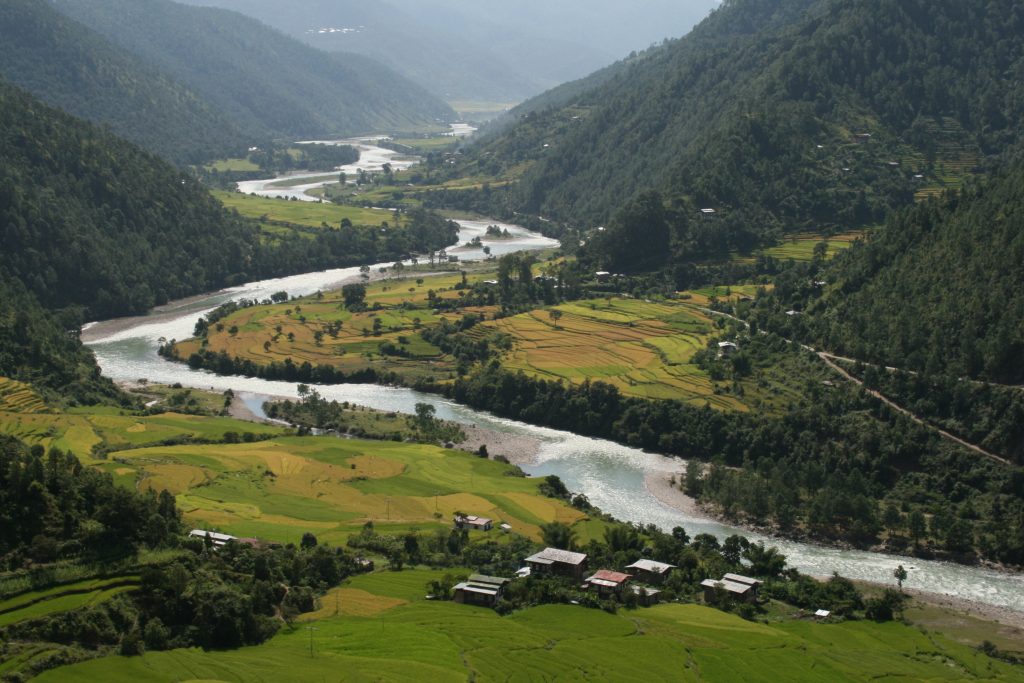
Winter Trek in Punakha
Duration : 08 DAYS Destination: Trekking Tour Packages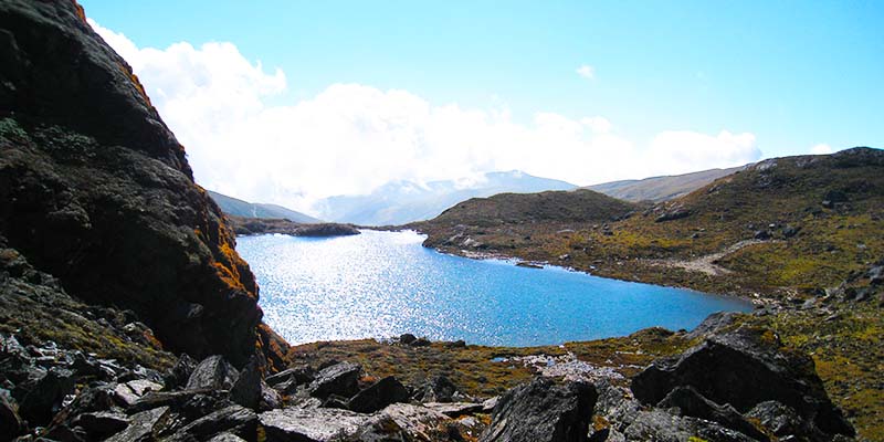
Shortest Trek in Bhutan
Duration : 08 DAYS Destination: Trekking Tour Packages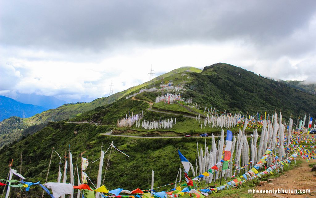
Sagala Trek in Chele La Paro
Duration : 10 DAYS Destination: Trekking Tour Packages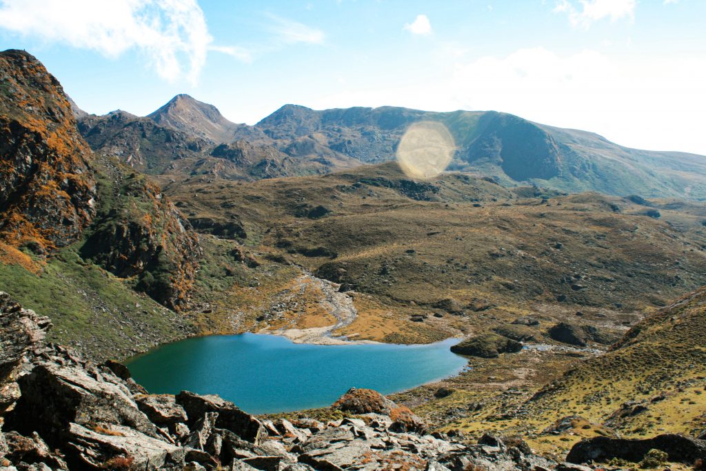
Dagala Best Trek in Bhutan
Duration : 10 DAYS Destination: Trekking Tour Packages